-
Keynote Speakers
Prof. Ruizhi Chen, Wuhan university, China.
Indoor positioning and mobile mapping
Dr. Ruizhi Chen received his PhD degree in Geodesy from University of Helsinki, MSc. degree in Computer Science and Engineering from Helsinki University of Technology, and BSc. in Surveying Engineering from Wuhan Technical University of Surveying and Mapping. Dr. Chen is currently the Director of the State Key Laboratory of Information Engineering in Surveying, Mapping and Remote Sensing, Wuhan University. He used to work an Endowed Chair and Professor in Texas A&M University Corpus Christ, U.S. and Head & Professor of the Department of Navigation and Positioning at the Finnish Geodetic Institute, Finland. He has published two books: Geospatial Computing in Mobile Devices and Ubiquitous Positioning and Mobile Location-Based Services in Smart Phones. He is an author/co-author of more than 160 scientific papers and 5 book chapters. His research results have been selected twice as cover stories in “GPS Worlds”. His Ph.D. students have received 7 international student paper awards, including 3 times of student-wining papers in the Institute of Navigation for 2010, 2012 and 2013. Dr. Chen is the general chair of the IEEE conferences “Ubiquitous Positioning, Indoor Navigation and Location-based Services” for 2010, 2012, 2014 and 2016. He is the Editor-in-Chief the Journal of Global Positioning Systems and associate editor of the Journal of Navigation. Dr. Chen was President of the International Association of Chinese Professionals in Global Positioning Systems (2008) and board member of the Nordic Institute of Navigation (2009-2012). Dr. Chen’s research interests include smartphone positioning indoors/outdoors, context awareness and satellite navigation.
Prof. Eberhard Gülch, Hochschule für Technik Stuttgart, Germany.
On automated industrial measurements using optical sensors and robots
Professor Eberhard Gülch is head of the Laboratory for Image Understanding and Earth Observations Sensors at the Stuttgart University of Applied Sciences. He is professor for photogrammetry and geoinformatics. Main research interests of professor Gülch are in the field of automation in digital photogrammetry and image understanding. He has been active member of remote sensing society, acting as various positions in German Society of Photogrammetry, Remote Sensing and Geoinformation (DGPF) and in International Society of Photogrammetry and Remote sensing (ISPRS).
Prof. Norbert Haala, Stuttgart University, Germany.
Dense Image Matching for 3D Data Collection in Urban Environments
Norbert Haala is Professor at the Institute for Photogrammetry, University of Stuttgart, where he is responsible for research and teaching in Photogrammetric Computer Vision and Image Processing. His main interests cover automatic approaches for image-based generation of high quality 3D data with a special focus on virtual city modeling. He is author of more than 200 papers and contributed in a number of projects both on basic research and commercial software developments. Norbert Haala is winner of the Carl Pulfrich Award in 2013 honoring his impacts to the development of photogrammetric restitutions, in particular in the areas of 3D City Modelling, Dense Multi View Stereo Image Matching and the use of Remotely Piloted Aircraft Systems (RPAS) for Remote Sensing applications.
Prof. Henrik Haggren, Aalto University, Finland
Photogrammetry in Industrial In-line Processes - Solving the Paradox
Henrik Haggrén (born 1950) is professor in photogrammetry in the Faculty of Built Environment at Aalto University School of Engineering, formerly TKK, since 1994.
His international acknowledgements include Carl Pulfrich Award 1991 from the Board of management of Carl Zeiss in recognition of outstanding project-related achievements in real-time, close-range photogrammetry, and Harper-Somers 1997 Fellow from the Institution of Surveyors Australia. He is a Corresponding Member of Deutsche Geodätische Kommission, DGK since 2002, and ordinary member of Finnish Academy of Technical Sciences since 2005. He is member of board of Mapvision Ltd. Haggrén is experienced in supervising postgraduate students, with 22 completed doctorates in photogrammetry and remote sensing since 1999. He publishes regularly in scientific journals and proceedings, and he has patents of photogrammetry systems and their industrial applications.
Prof. Andreas Nüchter, Julius-Maximilians-University Würzburg, Germany
SLAM for 3D Mapping
Andreas Nüchter is professor of computer science (telematics) at University of Würzburg. Before summer 2013 he headed as assistant professor the Automation group at Jacobs University Bremen. Prior he was a research associate at University of Osnabrück. Further past affiliations were with the Fraunhofer Institute for Autonomous Intelligent Systems (AIS, Sankt Augustin), the University of Bonn, from which he received the diploma degree in computer science in 2002 (best paper award by the German society of informatics (GI) for his thesis) and the Washington State University. He holds a doctorate degree (Dr. rer. nat) from University of Bonn. His thesis was shortlisted for the EURON PhD award. Andreas works on robotics and automation, cognitive systems and artificial intelligence. His main research interests include reliable robot control, 3D environment mapping, 3D vision, and laser scanning technologies, resulting in fast 3D scan matching algorithms that enable robots to perceive and map their environment in 3D representing the pose with 6 degrees of freedom. The capabilities of these robotic SLAM approaches were demonstrated at RoboCup Rescue competitions, ELROB and several other events. He is a member of the GI and the IEEE.
Dr. Prasad S. Thenkabail (USGS)
Hyperspectral Remote Sensing of Vegetation: Knowledge Gain and Knowledge Gap after 50 years of research
Dr. Prasad S. Thenkabail (Prasad) is a well known international expert in remote sensing science. He currently works as a Research Geographer-15 with the United States Geological Survey (USGS). Dr. Thenkabail has conducted pioneering scientific research work in two major areas:
1. Hyperspectral remote sensing of vegetation
2. Global Irrigated and Rainfed Cropland Mapping Recently he led a team in producing the world’s first 30-m Landsat time-series detived global cropland product that is available for browse @: croplands.org.Dr. Thenkabail is the current: 1. Editor-in- Chief of Remote Sensing Open Access Journal and is on the editorial board of Remote Sensing of Environment, 2. Associate Editor of the American Society of Photogrammetry and Remote Sensing (ASPRS) Journal Photogrammetric Engineering and Remote Sensing (PE&RS), and 3. Editorial Advisory Board member of the ISPRS Journal of Photogrammetry and Remote Sensing (P&RS). He was selected by NASA and USGS as a member of Landsat Science Team Member (2007-20011), and was a scientific advisory board member of Rapideye (2001).
Dr. Thenkabail is the Editor-in- Chief of seminal books:
1. three volume, 82 Chapter Magnus Opus, Remote Sensing Handbook (November 2015)
2. Hyperspectral Remote Sensing of Vegetation (2012)
3. Remote Sensing of Global Croplands for Food Security (2009)
Dr. Thenkabail’s accomplishments include: 100+ scientific papers, mostly peer-reviewed research papers in major International remote sensing journals. Thenkabail obtained Ph.D. from the Ohio State University, USA in March 1992.Prof. Antonio Tommaselli, Sao Paulo State University, Brazil.
Innovative spectral and 3D point cloud technologies for tropical environments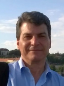
Antonio Maria Garcia Tommaselli holds a degree in Cartographic Engineering from São Paulo State University (1983), a Master degree in Geodetic Sciences from Paraná Federal University (1988) and Doctor Degree in Electric Engineering from Campinas State University (1993), licentiate in Photogrammetry by Unesp (1998), a posdoc fellow at University College London (1998). He is currently full professor at São Paulo State University. His is a member of the Advisory Committee of the Commission I of the International Society for Photogrammetry and Remote Sensing and member of the IAB (International Advisory Board) of the PHOTOGRAMMETRIC RECORD, jointly published by the Remote Sensing and Photogrammetry Society and Blackwell Publishing. He is also researcher level 1C (PQ 1C) of the National Council for Scientific and Technological Development (CNPq). He published 74 peer reviewed papers, 16 book chapters and 259 papers in national and international archives of scientific and professional conferences. He supervised 24 Ms students and 14 doctoral candidates. His interests are focused on Digital Photogrammetry, image orientation, sensor modelling and calibration, feature extraction
Prof. George Vosselman, University Twente, Netherlands.
3D indoor mapping with 2D laser scanners - first calibration, registration and SLAM results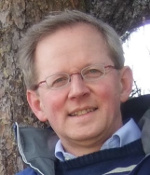
George Vosselman obtained his MSc degree in geodetic engineering at the Delft University of Technology, the Netherlands, in 1986 and his PhD degree at the University of Bonn, Germany, in 1991.
From 1987 to 1992 he was Researcher at the University of Stuttgart, Germany. After a year as visiting scientist at the University of Washington, he was appointed Professor in Photogrammetry and Remote Sensing at the Delft University of Technology in 1993. Since 2004 he is Professor in Geo-Information Extraction with Sensor Systems at the University of Twente, Enschede, the Netherlands. His research interests include information extraction from point clouds and imagery, 3D building and landscape modelling, quality analysis of point clouds, and sensor integration and fusion.
George Vosselman is board member of the Netherlands Geodetic Commission (NCG) and corresponding member of the German Geodetic Commission (DGK). He was Editor-in-Chief of the ISPRS Journal of Photogrammetry and Remote Sensing from 2004 to 2012 and is recipient of the Hansa Luftbild Award, the ISPRS Otto von Gruber Award, the Schwidefsky Medal, the Karl Kraus Medal, and the ASPRS Photogrammetric (Fairchild) Award.
More information spec3D@jyu.fi
Platinum sponsors
Gold sponsors
Silver sponsors

In collaboration with